
Herrington Lake 1952 USGS Topography Map Satin 24"'x36" Poster (210gsm) - Original/Natural Colors
Herrington Lake 1952 USGS Topography Map Satin 24"'x36" Poster (210gsm) - Original/Natural Colors
Couldn't load pickup availability
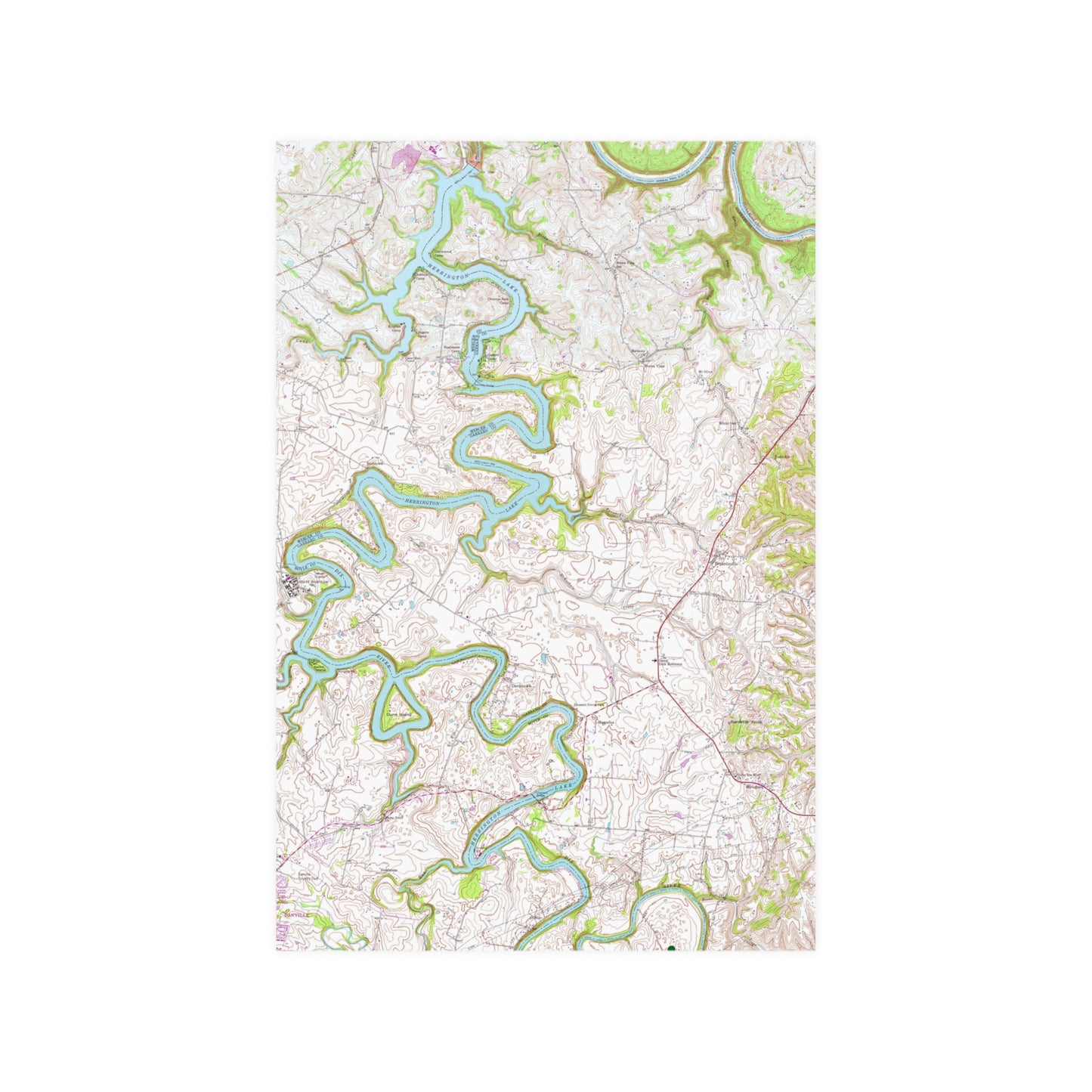
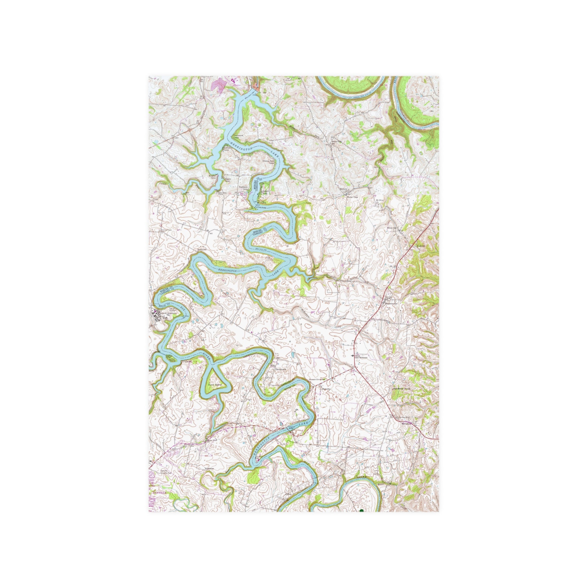
This 24"'x36" poster features a high-resolution copy of a hand drawn and inked 1952 map of the Herrington Lake area, produced by the United States Geologic Survey. This design is a combination of two "quadrangles" (the terminology used by the USGS for specific areas of land to be mapped) that are home to our favorite Kentucky lake, the Wilmore Quadrangle (the lake north of the Kennedy Bridge) and the Bryantsville Quadrangle (the lake south of the Kennedy Bridge). For this design, we have pieced the two separately hand-drawn maps together to form the complete tri-county area. This map represents it's original coloring, as drawn and inked by the USGS in 1952. This satin poster brings this print to life on top-tier quality 210 gsm satin paper, with a low-glare finish.
.: 210gsm satin paper
.: Horizontal and vertical options
.: Low-glare finish
.: NOTE! For indoor use only
Shipping & Returns
Shipping & Returns
Usually ships within 3 days of order, delivery in 5-8 business days (Economy). We keep you constantly updated by text and email. Free Economy shipping on all orders over $25 will apply automatically at checkout. No returns - please see Return/Refund Policy.
Share
We are a Kentucky-based company founded on Herrington Lake in Harrodsburg! All orders ship quickly via the USPS First Class Mail, with Tracking. Your order supports a family-owned and operated business. For immediate support and questions, call (859) 613-1959 or email info@herringtonlakeky.com.
View full details